Drone technology has transformed aerial surveying through better equipment and updated regulations. This has led to growing demand across construction, agriculture, environmental monitoring, and infrastructure inspection, where accurate drone surveys are now essential.

What is Drone Surveying?
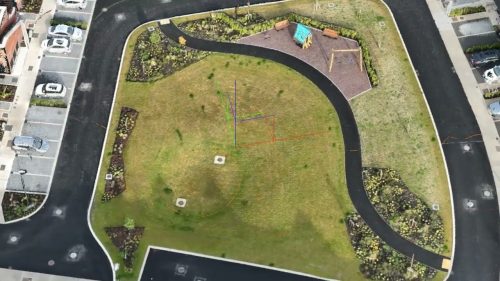
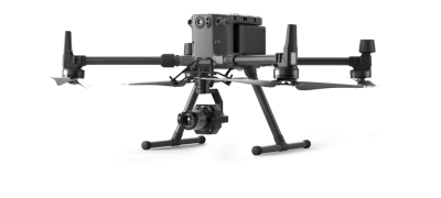
Drone surveying, also known as aerial surveying or aerial mapping, uses unmanned aerial vehicles (UAVs) equipped with high-resolution cameras, LiDAR sensors, and other advanced technology to capture detailed images and data of a specific area from above. These drones are controlled remotely by expert pilots, allowing them to fly over various terrains or infrastructures to identify the needs of a particular site.
Our drone surveys provide our clients with absolute accuracy and actionable data.
The Benefits of Our Drone Survey Services
1. Impact of Recent Regulation Changes on Drone Surveying
Recent regulation changes have significantly impacted how some drone operators complete or should be completing their missions. What was possible in the past may not be possible now under their current approvals. Regulators are clamping down more on illegal drone operations that put people at risk.
There have been some high-profile examples of this, including prosecution, published on social media platforms by the IAA in Ireland.
We consistently ensure that we follow all rules and regulations to ensure maximum quality for our clients that is safe and legally compliant.

2. Comprehensive UAV Survey Planning and Insurance
Many factors and significant planning protocols are involved in drone surveying. We operate safely and only take on jobs we know we can complete in compliance with our approved operations manual. We use the latest drone aerial survey equipment to provide high-resolution images, the highest-quality data deliverables, and flight path conditions. The data we collect is of the highest quality and at a resolution that most operators cannot compete with.
We also hold full public liability insurance for our topographic surveys, which covers us in case of any accidents or damages during our operations. This insurance provides peace of mind to our clients and ensures they are protected in any unforeseen circumstances.
3. Experienced and Certified Drone Pilots
Our team comprises the most experienced and qualified drone pilots in the country who have undergone extensive training and certification to operate drones safely and effectively. They have the skills and expertise to navigate diverse landscapes and challenging environments, ensuring smooth and successful drone operations.
Our pilots stay updated on the latest industry regulations and best practices, prioritising safety and minimal disruption at every stage of the flight.
4. In-House Data Processing For Impactful Drone Surveying Results
Another reason we seem more expensive is that we process the data ourselves. Many drone operators leverage cloud processing services and send the client the outputs. There are significant drawbacks to many of these services; some even have GDPR implications. We manually process and verify the UAV drone survey data through our established workflows to ensure we deliver quality, accurate data. We process on a local network with secure storage.
This approach gives us complete control over the processing workflow and allows us to stand over the results we provide. We do not use cloud-based data processing; We have complete end-to-end control over the deliverables.
We can provide 3D modelling that displays the accuracy within a few millimetres, orthomosaics with sub-centimeter accuracy, and digital elevation models (DEMs) with high precision. This level of detail and accuracy in our data processing sets us apart from other operators who may not have the same expertise or resources.
Accurately reconstructing an object in 3D takes planning, timing, and execution to deliver optimal outputs and high data processing quality.
You can have a look at some of our 3D models here.
5. Investing in Expertise and Technology for Superior Results
We invest heavily in top-of-the-line equipment and technology, ensuring we capture the highest quality images and accurate measurements for our clients. From high-resolution cameras to LiDAR drone sensors, we invest in cutting-edge tools that provide accurate and detailed results. This level of precision comes at a cost, but we ensure superior results for our clients.
This includes ongoing training for our team members to stay up-to-date with the latest industry standards and best practices. Additionally, we continually upgrade our equipment to ensure we use the most advanced drone surveying tools.
6. Fair Pricing and Professionalism
We price each UAV drone survey fairly and will talk with you if you get a cheaper quote. We do offer discounts for ongoing work or for repeat customers. We are highly professional drone surveyors, and our experienced operators allow us to complete more complex projects that others may not legally do.
Drone surveying surpasses traditional surveying methods in many ways, and we provide a cost-effective solution for collecting accurate and detailed data. While our prices may seem higher than those of some other operators, it is essential to consider the value of our expertise, in-house data processing, and investment in technology for each project.


