Drone Survey Services in Limerick
Professional Drone Surveying Solutions in Limerick
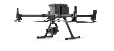
Drone Services Ireland provides specialist drone survey services in Limerick for construction, infrastructure, and land management projects. Using advanced drone technology such as the DJI M300 RTK equipped with LiDAR and high-resolution cameras, we capture accurate data that saves time and reduces costs. From Limerick City to towns like Newcastle West, Adare, and Abbeyfeale, our surveys are tailored to meet the needs of engineers, surveyors, and local businesses.
Our Limerick Drone Services
We provide a full range of professional aerial survey solutions:
LiDAR Drone Surveys Limerick – Capture millions of data points for terrain mapping, flood risk assessment, and site planning.
Roof & Structural Surveys Limerick – Safely inspect hard-to-reach roofs and building façades without the need for scaffolding.
Topographical Drone Surveys Limerick – Generate highly accurate site maps for roadworks, construction, and land development.
Drone Mapping & Photogrammetry Limerick – Create detailed orthomosaics, contour maps, and volumetric reports.
Thermal Drone Inspections Limerick – Detect hidden issues in commercial and residential properties, such as insulation leaks and water damage.
Drone Survey Cost & Pricing
The simple answer is that pricing varies based on several factors. There is no one-size-fits-all approach to drone survey costs, as each project is unique.
The location, size of the project, time of year, weather, airspace, and surrounding areas, such as roads and building structures, can all affect pricing.
We customise our drone land surveying prices to provide clients with the best possible data at a very reasonable price.
A drone topographic survey can achieve savings of up to 65-70%.
We consider all these and provide a custom price per job based on these variables.
Drone Services Ireland is recognised as one of Ireland’s leading drone survey companies, providing the highest quality digital aerial land surveys.


Why Choose Drone Services Ireland in Limerick?
Our clients in Limerick trust us because:
We know the region and have carried out projects across Limerick City and surrounding areas
We use state-of-the-art drones with LiDAR and RTK capabilities for maximum accuracy
Our surveys are faster and safer than traditional ground methods
Data can be delivered in multiple formats ready for CAD, GIS, or BIM platforms
Recent Drone Survey Project in Limerick
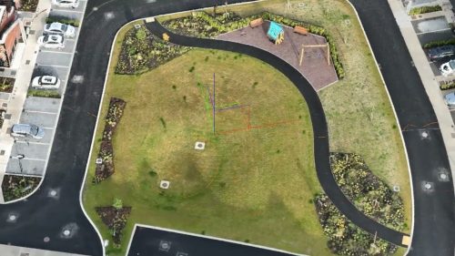
Our team recently completed a topographical drone survey near Limerick City for a road improvement project. The aerial data provided engineers with a precise digital terrain model that supported design work while reducing disruption to local traffic.
Areas We Serve in Limerick
We provide drone surveying across:
Limerick City
West Limerick, including Newcastle West and Abbeyfeale
Mid Limerick, including Adare and Patrickswell
East Limerick, including Castleconnell and Cappamore


