Drones in Architecture
How are drones in Architecture used?
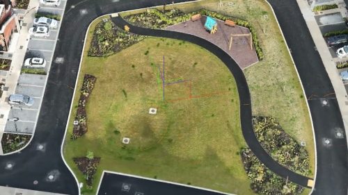
Drones provide a unique aerial view that provides spatial awareness and relativity to planning and design. An elevated view from a specific height can reveal views and obstructions, allowing designs to be altered before submission.
Drones solve the problems of obtaining elevated views easily from different heights, directions, and viewpoints, saving time and money, and with the additional safety of not putting a person at risk on a MEWP or at the top of another building. The flexibility to obtain exact positions streamlines the entire process and can help avoid issues related to access to adjacent properties.
Problems Solved by the use of drones in architecture:
Time and Cost Savings: Traditional surveying methods can be time-consuming and expensive. Drones significantly speed up the process and reduce labour costs.
Improved Accuracy & Detail: Drones capture comprehensive data, including precise position data, offering more detail than traditional methods or satellite imagery, which might lack precision for aligning designs.
Accessibility: Drones can access difficult-to-reach or hazardous areas safely, providing data that would be challenging or risky to obtain manually.
Enhanced Contextual Understanding: Aerial imagery provides architects with a unique perspective of the site and its surroundings, facilitating more informed design decisions.
Type of Drone Services for Architecture
- Specific altitude panorama surveys
- Line of Sight inspections up to approx 15km
- CGI images – ground and aerial
- Surveying and Aerial Mapping of the entire site as a surface for drawings
- Impact analysis surveys and assessments
- Conservation inspections with no building impact
- 3D model of the base surface to overlay projects on
Design Visualisation and Presentation:
How Drones Are Used: Drones provide high-quality aerial photography and videography. The 3D models created from drone data can be integrated into Building Information Modelling (BIM) and Computer-Aided Design (CAD) software.
Problems Solved:
Better Visualisation: 2D designs often fail to illustrate full spatial information. Drone-created 3D models help architects and clients visualise designs more effectively in a real-world context.
Improved Design Alignment: Drone models can be fitted into BIM designs, helping to verify and optimise designs against the actual site conditions.
Enhanced Marketing and Client Communication: Compelling aerial shots and 3D visualisations make for powerful marketing materials, helping architects communicate their design intent more clearly to clients and stakeholders.

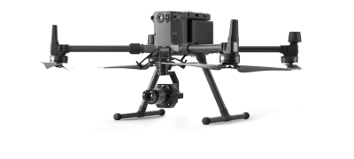
Our high-end optical zoom cameras allow us to capture minute details from a safe distance on conservation projects.
No scaffolding is required, meaning the risk to the building or structure is minimised. High-resolution aerial images are gathered as evidence and assist with documenting defects and the current state of the structure.
3D models can further enhance visualisation, allowing a fully interactive vision of objects from the comfort of your office. Objects can be placed into a scene, such as buildings, to help assess how it will impact the surrounding area and properties.


