Drone Construction Progress Monitoring
Expertly Overseeing Your Entire Project From Start to Finish
- Fully Licensed and Insured
- Undertaking Work for the Construction Industry in the Republic of Ireland
- Detailed Drone Construction Photography
- Detailed Reports and Accurate Measurements
- Cost-effective Drone Construction Inspection and Monitoring


Providing Construction Professionals With Accurate Construction Drone Mapping
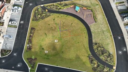
Drone construction mapping provides a high-resolution, real-time visual representation of construction sites, offering invaluable insights into project monitoring, site safety, and project management.
At Drone Services Ireland, we provide drone construction services for your projects. We handle the compliance, safety, and regulatory requirements to provide you with the aerial data you need.
Some of the drone services for construction we provide include:
- Weekly, biweekly, or monthly progress reporting
- Drone aerial photography and video of construction projects
- Ground-based drone construction site photography
- Full-site mapping, including overlays
- 2D and 3D progress reporting using a custom portal
- Survey-grade aerial surveys
- Fixed time-lapse cameras
- Custom-hosted maps with a date stamp and points of Interest annotations
- Health and Safety audits
- Site security assessment: see from the air what isn’t apparent from the ground
Drone Construction Photography
We provide construction drone services for clients with projects of all sizes, from small residential builds to large-scale developments.
We gather 1080p or 4K aerial footage and high-resolution images for our drone construction services. It can be hosted online using our custom platform or transferred to the client anytime. This gives an instant, unique perspective of the site during the construction phase.
The hosting is online via password protection with a private URL. Many clients use the footage we capture as an audit trail for payment milestones and project financing. The ability to easily share project progress with third parties and financial institutions can significantly speed up the process.
We value our client’s privacy and ensure that we are GDPR compliant.

We Provide Complete, End-to-End Services in Drone Construction Monitoring During the Entire Construction Project
Whole Site Mapping
The aerial mapping process involves capturing a series of images in a grid pattern to cover the extent of the site. We then process these images and “stitch” them into one large site map. The drone construction site photography can be transferred to the client or hosted online for easy sharing with teams and suppliers. We can also date stamp and customise these maps to show the site’s progress. This allows visualisation of the site; we now offer this service in 3D and 2D options. Contact us today, and we will send you a link to a sample map.
Aerial Surveys
Using drone technology to supplement and speed up traditional surveying, gather actionable data from stockpiles, or calculate material removal quantities. This is now faster and safer, as all data is gathered without shutting down the site or putting surveyors in harm’s way. The speed of data collection allows for quicker decision-making; we can have these surveys turned around in hours if required.
Health and Safety Audits
Using drones, we record site activity during normal operations. This has many benefits for improving site safety and reducing hazards and accidents. Aerial perspective allows you to see what’s not apparent from the ground. There is no disruption to the site; the audit is done during the full activity. We capture “real” activity on site, not pre-warned inspections. This reduces the risk to safety officers by preventing them from being in harm’s way.
Site Security Audits
An often overlooked aspect when sites are being set up is equipment safety. An aerial site security assessment can show weak and vulnerable entry points. Surrounding vulnerabilities can lead to theft or damage on-site. Having routine construction drone services such as mapping and inspecting construction sites provides a point-in-time reference for security managers and insurance purposes. Our drone pilots are the ultimate professionals and have completed safe-pass courses for working in the construction sector. We take care of all elements of the construction progress monitoring operations, including planning, executing, and processing the data.
Time-Lapse Cameras
Fixed cameras on site capture still images every number of seconds or minutes over long periods. This records progress from start to finish and can be configured to work during specific work hours. We offer several solutions, from the lower end to our high-end solar-powered offering with 4G connectivity for real-time remote access. This option is a valuable extension to our construction drone services and allows constant site monitoring. We can create custom time-lapse sequences for specific times and dates at short notice and share the results within minutes.
Industry Experts in Construction Drone Mapping and Monitoring
We are experienced industry experts in construction drone mapping. Our team is knowledgeable and experienced in the most advanced software in drone technology and its use for real-time information in construction mapping and surveying.
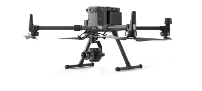
Our drones have advanced sensors and cameras to capture high-resolution aerial images and data. We use the latest software technology to process this data, creating accurate 3D models, topographical maps, and other valuable outputs for up-to-date, real-time data.

Drone Construction Monitoring and Mapping FAQs
Learn more about our Drone construction monitoring and mapping services

How are drones used in construction industry?
Many companies now supply project managers or individuals on-site with drones. Drones can be easy to operate, but capturing the data you need most in a safe and legal way requires the experience and professionalism of a drone service provider.
We work with some of the industry’s leading construction and development companies, providing drone construction services to local and global-based companies.
From simple photo and video overviews of the whole site to interactive 3D models, 360 panoramas, and aerial site maps with real, measurable data can keep projects on track, assist with project management and even pave the way for payment milestones to be made.
What does drone mapping for construction involve?
Construction firms can benefit from various construction drone services, such as aerial photography, mapping, and inspections. Our team of drone pilots will capture images or video from multiple angles and heights at different points throughout the project’s timeline. This real-time data is then used to create detailed 2D maps or 3D models of the area in question, which can be used for surveying and planning. The mapping type depends on the project requirements and the nature of the construction.
What are the benefits of drones in construction over a manual inspection?
One of the main advantages is speed. With drones, you can capture aerial imagery and data much faster than traditional manual methods. This allows for more frequent inspections and a quicker response to any anomalies or issues on-site.
Additionally, drones can capture high-resolution photos and videos of inaccessible areas with traditional surveying methods. This eliminates the need for personnel to be harmed during a visual inspection.
Can you provide general drone construction site photography?
Yes, in addition to providing detailed aerial imaging for mapping purposes, our drones can also be used for general construction site photography. This can include creating marketing images and videos of the project’s progress or capturing unique angles of the finished product. Our team is experienced in all aspects of drone construction monitoring and will provide you with a bespoke service tailored to your specific needs.


