Drone Survey Services in Galway
Professional Aerial Surveys in Galway
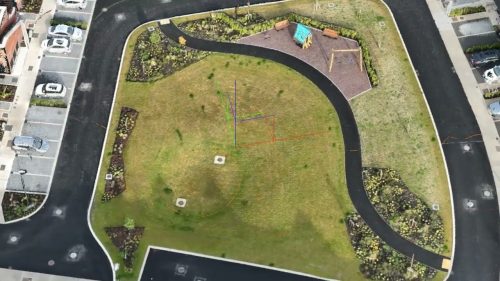
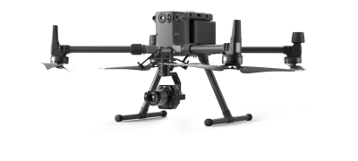
Drone Services Ireland provides trusted drone surveying and inspection services in Galway for developers, engineers, and local authorities. With advanced UAVs such as the DJI M300 RTK paired with LiDAR and photogrammetry tools, we deliver detailed results quickly and safely. From Galway City to towns like Tuam, Athenry, and Ballinasloe, our aerial survey services support projects of every size.
Our Drone Survey Services in Galway
Our Galway services include:
Drone LiDAR Surveys Galway – Create high-accuracy 3D terrain models for planning and infrastructure projects
Drone Roof Surveys Galway – Safely assess industrial, commercial, and residential roofs
Drone Topographical Surveys Galway – Provide site data for roadworks, land development, and engineering projects
Drone Mapping and Photogrammetry Galway – Produce orthomosaics, 3D models, and volume calculations
Thermal Drone Surveys Galway – Highlight energy loss, insulation problems, and hidden water damage
Drone Survey Cost & Pricing
The simple answer is that pricing varies based on several factors. There is no one-size-fits-all approach to drone survey costs, as each project is unique.
The location, size of the project, time of year, weather, airspace, and surrounding areas, such as roads and building structures, can all affect pricing.
We customise our drone land surveying prices to provide clients with the best possible data at a very reasonable price.
A drone topographic survey can achieve savings of up to 65-70%.
We consider all these and provide a custom price per job based on these variables.
Drone Services Ireland is recognised as one of Ireland’s leading drone survey companies, providing the highest quality digital aerial land surveys.


Why Work With Drone Services Ireland in Galway?
Clients in Galway choose us because:
We cover Galway City as well as Oranmore, Tuam, Athenry, Ballinasloe, and Connemara
Our technology includes LiDAR, RTK drones, and GNSS integration for unmatched precision
We deliver results faster and at lower cost compared to traditional survey methods
Our team has experience across multiple sectors including construction, agriculture, and renewable energy
Drone Survey Project Example in Galway
We recently carried out a LiDAR drone survey for a renewable energy project in Connemara. The survey provided a complete terrain model across challenging landscapes, giving planners the accurate data required for turbine placement without costly ground-based surveys.
Areas We Serve in Galway
We provide drone surveying across:
Galway City
East Galway, including Athenry, Ballinasloe, and Loughrea
North Galway, including Tuam and Headford
West Galway, including Clifden and Connemara


