The construction and engineering sectors across Ireland are undergoing a significant transformation in how site data is captured and analysed. Drone surveying has evolved from experimental technology to an essential service, transforming project delivery from initial site assessment to final handover. For professionals managing quarries, construction sites, land surveys, and renewable energy developments, understanding drone surveying is no longer optional.

Understanding Drone Surveying Technology
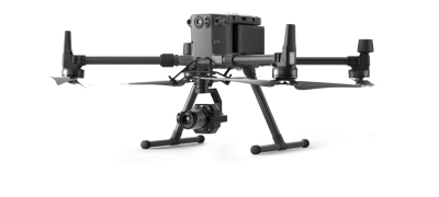
Drone surveying is the process of using unmanned aerial vehicles equipped with high-resolution cameras, LiDAR sensors, and precise GNSS positioning systems to capture accurate geospatial data from above. Unlike traditional ground-based methods, which require survey crews to physically traverse sites with total stations and GPS rovers, drones can collect comprehensive site information from the air in a fraction of the time.
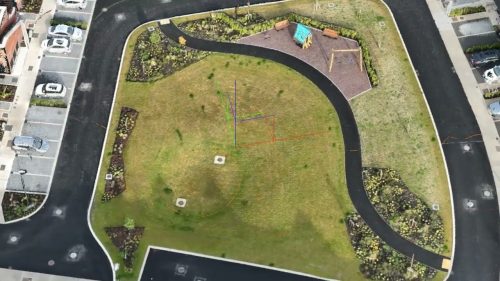
The technology works by flying predetermined flight paths over your site, capturing hundreds or thousands of overlapping images or laser measurements. Advanced photogrammetry software then processes this raw data into usable outputs, including orthomosaic maps, digital elevation models, 3D point clouds, and contour plans. Modern RTK and PPK systems deliver centimetre-level accuracy, meeting or exceeding the precision requirements for most engineering applications.
Research shows that drone surveys can reduce data collection time by up to 60% compared to traditional methods, whilst maintaining survey-grade accuracy of 1 to 3 centimetres. This isn’t just faster work; it’s fundamentally better data that gives project teams more confidence in their decisions.
How Drone Surveying Works in Practice
The drone surveying process follows a systematic workflow designed to maximise accuracy whilst minimising time on site. Drone Services Ireland typically begins with mission planning, where flight paths are programmed based on the site boundaries, required ground sampling distance, and survey deliverables needed. Ground control points may be established at strategic locations throughout the project/site.
During the flight, which might last anywhere from 20 minutes to several hours, depending on site size, the drone automatically captures data along its programmed route. RTK positioning ensures each image or laser scan is tagged with precise coordinates, eliminating much of the post-processing correction work that plagued earlier drone surveying methods.
Back in the office, specialist software processes the collected data through photogrammetric or LiDAR workflows, generating the final survey outputs. These integrate seamlessly with CAD platforms like AutoCAD Civil 3D, BIM software including Revit, and GIS systems, allowing engineers and designers to begin work immediately.
Ready to experience faster, more accurate site surveys? Contact Drone Services Ireland for a no-obligation consultation about your next project.

Key Applications Across Irish Industries
Quarrying and Extractive Industries
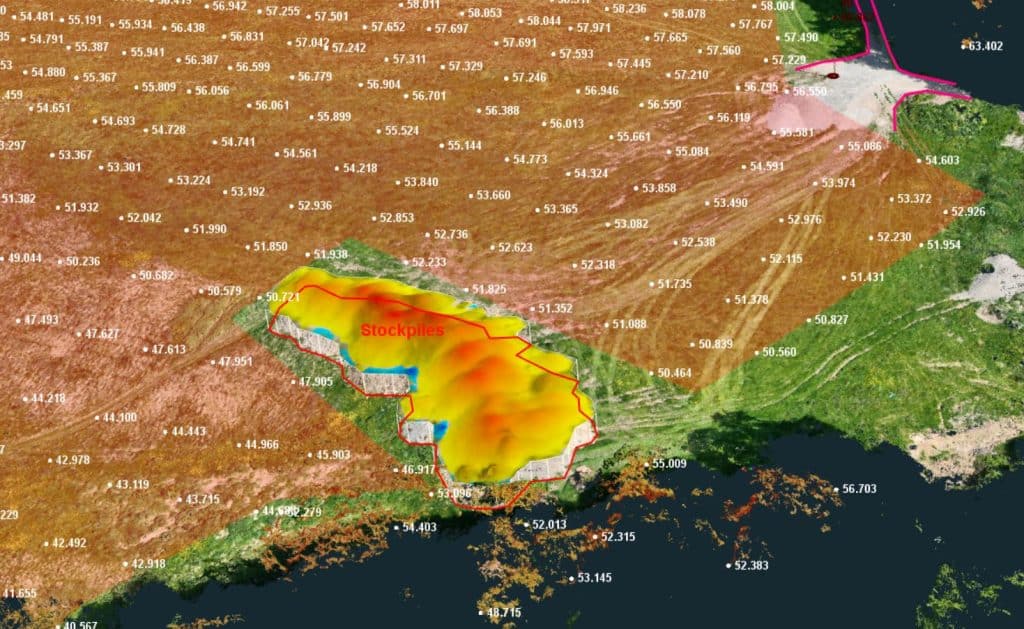
Quarry operators face unique challenges around safety and operational efficiency. Drone surveying removes personnel from hazardous areas near unstable faces, active haul roads, and crushing equipment. Volumetric stockpile measurements that once required days of work with rovers can now be completed in under an hour, providing real-time inventory data for production planning. Progressive subsidence monitoring tracks ground movement with 5-centimetre precision, identifying potential stability issues before they become critical safety concerns.
Land Development and Topographic Surveys
For land development projects, drone surveys capture comprehensive topographic data across sites of any size. A 50-hectare greenfield site that might require a week of traditional surveying can be flown in a single morning, with processed deliverables available within 48 hours. The resulting digital terrain models support everything from drainage design and earthworks calculations to planning applications and environmental impact assessments.
Construction Site Management
Construction sites benefit from drone surveying throughout the entire project lifecycle. Initial existing conditions surveys inform design decisions, progress monitoring tracks work against programmes, and as-built documentation verifies final conditions. The technology excels at identifying discrepancies between design intent and actual construction, catching costly errors before they compound. Major infrastructure projects, such as the M11 Gorey to Enniscorthy scheme, demonstrate how regular drone surveys support effective project control on complex sites.
Planning and Compliance
Planning authorities and developers increasingly rely on accurate geospatial data for decision-making. Drone surveys provide the foundation for masterplanning exercises, site feasibility studies, and environmental baseline assessments. With Ireland’s planning system emphasising digital submissions and BIM integration, drone-captured data meets these requirements whilst significantly reducing survey costs.
From quarries to construction sites, we’ve surveyed them all. Let’s explore how point cloud technology can address your unique surveying challenges.
Renewable Energy Sector Applications
Solar Farm Development and Monitoring
Ireland’s growing solar sector relies heavily on accurate site data throughout project lifecycles. Initial feasibility studies use drone surveys to analyse terrain, identify shading from treelines or structures, and optimise panel layouts for maximum generation. During construction, weekly or monthly surveys track progress against the programme, verify panel placement accuracy, and support payment applications. Operational solar farms use thermal imaging drones to identify underperforming panels or electrical faults, maximising energy output and return on investment.
Wind Energy Site Assessment
Wind farm developments, both onshore and the expanding offshore sector, depend on detailed topographic information for turbine micro-siting, access road design, and grid connection planning. Drone surveys capture existing terrain conditions with the precision needed for foundation engineering calculations and cut-fill analysis. During the construction of Ireland’s expanding wind portfolio, regular surveys monitor earthworks volumes, track construction progress, and provide visual records for stakeholder reporting.
The Drone Services Ireland Advantage
Selecting the ideal drone surveying provider entails more than simply hiring a pilot. Drone Services Ireland combines EASA-certified commercial operators with engineering expertise, ensuring deliverables are survey-grade and fit for purpose. Full public liability insurance, SafePass certification for construction site access, and comprehensive post-processing capabilities mean you receive actionable data, not just pretty pictures.
Integration with industry-standard software platforms, adherence to Irish spatial reference systems, and experience across construction, quarrying, and renewable energy sectors ensure your survey data works seamlessly within existing project workflows.
The Bottom Line
As Ireland invests heavily in infrastructure, housing, and renewable energy, the construction and engineering sectors need faster, more accurate, and safer methods of capturing site information. Drone surveying delivers on all three fronts whilst reducing costs and improving project outcomes.
The evidence is clear. Studies show drone surveys reduce field time by 60-70%, achieve accuracy within 2-3 centimetres, and significantly enhance safety by removing personnel from hazardous areas. Whether you’re calculating stockpile volumes in a quarry, monitoring construction progress on a housing development, or optimising turbine placement for a wind farm, drone surveying provides the data quality and speed that modern projects demand.
Don’t let outdated surveying methods slow down your projects. Contact Drone Services Ireland today to learn how our drone surveying solutions can save you time, reduce costs, and improve accuracy across your sites.


