Point cloud technology is revolutionising how construction and engineering professionals approach site surveying, project planning, and infrastructure development across Ireland. With the Irish government’s BIM mandate taking effect and ambitious renewable energy targets on the horizon, understanding this technology has never been more critical for your projects.

What Exactly is Point Cloud Data?
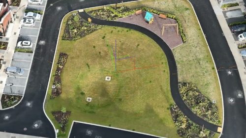
A point cloud is essentially a digital fingerprint of your site. It’s a collection of millions of data points mapped in three-dimensional space, with each point containing precise X, Y, and Z coordinates that represent the exact position of surfaces, structures, and terrain features.
Think of it as creating a highly detailed 3D copy of the real world that you can measure, analyse, and manipulate without ever returning to the site. This data serves as the foundation for various applications, including volumetric calculations, cut-fill analysis, and the generation of accurate BIM models, as well as tracking construction progress over time.
Ready to see what point cloud data can reveal about your site? Contact Drone Services Ireland for a no-obligation consultation and discover how we can support your next project.
How Drones Capture Point Cloud Data
Drone surveying generates point cloud data through two primary methods, each with distinct advantages.
Photogrammetry uses high-resolution cameras to capture hundreds of overlapping images as the drone flies predetermined paths over your site. Specialised software then identifies common features across these images and uses triangulation to calculate the 3D position of millions of points, much like human depth perception works with two eyes. The result is a dense, colourised point cloud that provides photorealistic detail.
LiDAR (Light Detection and Ranging) takes a different approach. The drone-mounted sensor emits rapid laser pulses, often hundreds of thousands per second, that bounce off surfaces below. By measuring the time it takes for each pulse to return and combining this with precise GPS positioning and orientation data, the system calculates exact distances to create accurate 3D points. LiDAR’s key advantage is its ability to penetrate vegetation gaps, capturing both canopy and ground surfaces beneath, making it invaluable for sites with heavy vegetation or complex structures.
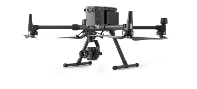
Modern drone systems equipped with RTK (Real-Time Kinematic) or PPK (Post-Processed Kinematic) positioning achieve survey-grade accuracy of 2 to 6 centimetres, comparable to traditional total station methods. Drone Services Ireland utilises enterprise-grade platforms that operate under strict EASA regulations to ensure safety and data quality.

Point Cloud Applications Across Key Industries
From quarries to construction sites, we’ve surveyed them all. Let’s discuss how point cloud technology can solve your specific surveying challenges.
Quarrying Operations
Quarrying operations benefit enormously from drone-based point clouds. Rather than sending surveyors into potentially hazardous areas near unstable rock faces or active extraction zones, operators can now conduct remote volumetric stockpile measurements, monitor ground subsidence with 10-centimetre accuracy, and perform geotechnical analysis from safe distances.
Recent projects have demonstrated efficiency improvements of five times that of traditional methods, with surveys that once took days now being completed in hours.
Land Surveying
Land surveying has been transformed by the technology’s ability to capture comprehensive topographic data in a single flight. What traditionally required days of fieldwork with survey crews can now be accomplished in hours, providing digital terrain models, contour maps, and georeferenced orthomosaics that integrate seamlessly with CAD and GIS systems.
This speed advantage is particularly valuable for large infrastructure projects under Ireland’s National Development Plan, where time savings translate directly to cost reductions.
Construction Projects
In the construction sector, point clouds serve project needs from initial site assessment through to final as-built documentation. They enable scan-to-BIM workflows for renovation projects, support clash detection during design phases, and provide real-time progress monitoring against planned schedules.
Major projects, such as the Dunkettle Interchange in Cork, which handles 120,000 vehicles daily, exemplify the scale of infrastructure where drone surveying delivers measurable value through enhanced coordination and quality control.
Planning and BIM Integration
Planning processes become more data-driven when point clouds feed into BIM workflows. With Ireland’s BIM mandate requiring projects exceeding €20 million to adopt these standards, and full implementation planned by 2028, the ability to generate accurate existing conditions data quickly positions drone surveying as a vital service.
Planners can simulate design changes, identify potential issues early, and make confident decisions based on precise spatial information rather than estimates or outdated surveys.
Point Clouds for Renewable Energy Development
Point cloud technology is particularly transformative for Ireland’s rapidly expanding renewable energy sector. With the government targeting 5 gigawatts of offshore wind capacity by 2030 and significant growth in solar installations, accurate site data is critical.
Solar Farm Developments
For solar farm developments, drone-generated point clouds enable optimal panel placement by mapping terrain in detail, conducting shadow analysis from surrounding features, and planning drainage and access roads with precision.
During construction, regular surveys track progress and verify installations match design specifications. Throughout the operation, thermal imaging combined with 3D mapping identifies underperforming panels quickly, maximising energy production. Recent large-scale solar projects demonstrate how point cloud data supports everything from initial feasibility studies through decades of operational maintenance.
Wind Farm Site Assessment
Wind farm developments rely heavily on LiDAR for wind resource assessment, measuring vertical wind profiles up to 300 meters at multiple heights simultaneously. This data drives micro-siting decisions, optimising turbine placement for maximum energy capture while avoiding obstacles and wake effects.
For offshore projects, including several major developments off Ireland’s east and south coasts, floating LiDAR platforms create virtual measurement stations far cheaper and faster than traditional meteorological masts. During operations, nacelle-mounted LiDAR enables advanced control systems that increase generation by over 2% through intelligent yaw control and load reduction.
Why Choose Professional Drone Services?
Drone Services Ireland has over adecade of drone surveying operations experience and operates in accordance with clear EASA regulations, carries comprehensive insurance, and combines engineering expertise with piloting skills. This ensures not only compliant flights but also the interpretation of data by professionals who understand construction and engineering workflows.
With SafePass certification for site access and integration capabilities with BIM platforms like Revit and AutoCAD, professional drone services deliver actionable intelligence, not just raw data.
The Bottom Line
As Ireland invests €165 billion in infrastructure and pursues ambitious renewable energy targets, point cloud technology captured by drones offers construction and engineering professionals a proven path to safer, faster, and more cost-effective project delivery.
The question isn’t whether to adopt this technology, but how quickly you can integrate it into your workflows. Whether you’re managing quarry operations, planning large-scale construction projects, or developing the next generation of renewable energy infrastructure, point cloud data provides the accuracy and efficiency your projects demand.
Don’t let outdated surveying methods slow down your projects. Contact Drone Services Ireland today to learn how our point cloud solutions can save you time, reduce costs, and improve accuracy.


