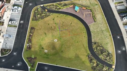
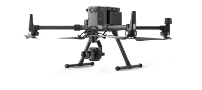
Drone surveys transform construction and infrastructure projects through advanced aerial imaging. Our UAV technology delivers comprehensive site data, from detailed progress monitoring to precise measurements, revolutionising project delivery and enhancing efficiency. From initial site assessment to completion documentation, aerial drone surveys provide actionable insights that streamline decision-making and reduce costs.

The Role of Aerial Drone Surveys in Construction and Infrastructure Projects
Aerial drone surveys play a crucial role in construction and infrastructure projects, providing valuable information and insights at regular intervals of the project lifecycle. Here are some of the critical roles that surveys play in these projects:
Risk Assessment Surveys
Drone surveys can be conducted to identify potential risks and challenges associated with the project, allowing project managers to implement mitigation strategies.
Stakeholder Communication
In projects that affect the general public, surveys may be used to proactively identify changes and detail the progress of any construction or infrastructure project. Aerial drone surveys can also gauge public opinion, address concerns, and involve stakeholders in decision-making.
Quality Control
When construction or infrastructure is complete, as-built surveys record the project’s final “as-built” state. This information is essential for future upkeep, changes, meeting regulatory rules, and identifying structural issues.
Project Monitoring
Aerial drone surveys follow the construction activities as they progress over time. They assist project managers in checking compliance with deadlines, spotting potential issues during the construction phase and making smart choices to ensure the project’s success.
The Challenges and Limitations of Traditional Surveying Methods
Traditional surveying methods are time-consuming and require extensive resources, manpower and potentially heavy machinery. In addition, carrying out work in dangerous conditions during a traditional survey could pose a risk of accidents.
In contrast, drone aerial surveys offer a more efficient alternative. Drones with high-resolution cameras and sensors can quickly capture images and videos from various angles and heights.
This provides a comprehensive view of the construction site or infrastructure project, providing valuable information for planning, design, and monitoring purposes.
Don’t let traditional methods slow you down – take advantage of our UAV mapping services for efficient data collection and analysis!
What Are Aerial Mapping Services?
Drone aerial mapping, or UAV aerial mapping, occurs when drones with cameras or other advanced sensors take high-quality images, videos, or other data from the air. This data is then used to make precise and detailed maps or 3D models of the surveyed area. Drone mapping is prevalent in many industries because it is fast, cost-effective, and can obtain data from hard-to-reach areas.
What Are The Key Benefits of UAV Mapping?
UAV mapping has extensive uses and benefits several industries, from mining to emergency response and disaster resource planning, construction, and infrastructure.
Rapid Data Collection
UAV mapping is crucial to fast data collection. Drones with high-resolution cameras and sensors can quickly take images and videos of the construction site or infrastructure project from different angles and heights, giving a complete and detailed view of the area.
Improved Accuracy
Another benefit of drone aerial surveys and UAV mapping is the improved accuracy of data collection. Traditional surveying methods can be prone to human errors, measurement inaccuracies, and inconsistencies. With drones, the data collected is precise and reliable, as the cameras and sensors on board can capture accurate measurements and details.
This level of accuracy is crucial in construction and infrastructure projects, as it ensures that the design, planning, and execution are based on precise data.
Cost-Effective
Drone aerial surveys offer a cost-effective solution compared to traditional surveying methods. Traditional surveys often require large teams of surveyors, expensive equipment, and extensive fieldwork.
This can result in high construction or infrastructure project costs. On the other hand, drones require minimal manpower and can cover large areas quickly, reducing the overall cost of data collection and surveying.
Improved Safety
Using UAVs for aerial surveys minimises potential risks to human surveyors working in hazardous or hard-to-reach locations. This enhances overall safety in construction, mining, and disaster response industries.
Versatility in Sensors
UAVs have different sensor options, such as RGB, multispectral, LiDAR, and thermal cameras. This flexibility lets them adapt to the specific needs of the mapping project.
Time-Saving and Cost-Effective Drone Mapping Services From Experts
Drone Services Ireland’s skilled team harnesses cutting-edge drone technology to streamline data collection, capture high-resolution imagery, and deliver precise information across diverse industries.
Incorporating drones into your business operations allows us to drastically minimise survey times for expansive areas compared to conventional methods. Our drones can cover more ground swiftly, enabling prompt access to critical data and expediting project timelines.
If you need to speak to us about a drone survey, whether you’re a construction manager of a large site or are an individual with a select few properties to survey, contact Drone Services Ireland today.


