BIM Drone Surveys with Revit-Ready Point Clouds
BIM-based projects need accurate existing-conditions data at every stage – pre-design, during construction, and at handover. Drone surveys deliver that data faster than traditional ground methods, in formats that drop straight into Revit, Bentley, Navisworks, and ArchiCAD – all in ITM coordinates compatible with Irish national BIM standards.
BIM survey pricing from €750
Last updated: April 2026
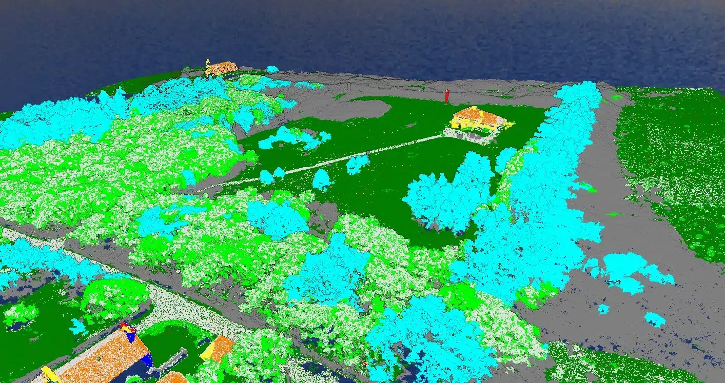
BIM drone survey in Ireland. Revit-ready existing-conditions point clouds (LAS/LAZ + RCP) and DXF/DWG that drop straight into Revit, Bentley, Navisworks and ArchiCAD - LOD 200 (configurable to LOD 300), ISO 19650-compatible, all in ITM. From €750.
| Specification | Detail |
|---|---|
| Pricing | from €750 |
| Deliverables | LAS/LAZ + RCP point cloud, IFC 4 export, classified DTM, DXF/DWG |
| Software | Revit, Bentley, Navisworks, ArchiCAD |
| Level of detail | LOD 200 default (configurable to LOD 300) |
| Standards | ISO 19650 CDE compatible |
| Coordinate system | ITM / EPSG 2157 + OSGM15 heights |
| Turnaround | 2 working days |
Key BIM Deliverables
Survey-grade existing-conditions data formatted to drop straight into your BIM environment – no manual re-drawing.
Georeferenced Point Cloud
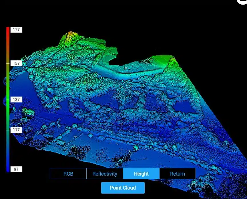
LAS/LAZ point cloud, fully georeferenced to ITM. Ready to import into Revit, Bentley, or Navisworks as existing-conditions reference.
Classified DTM
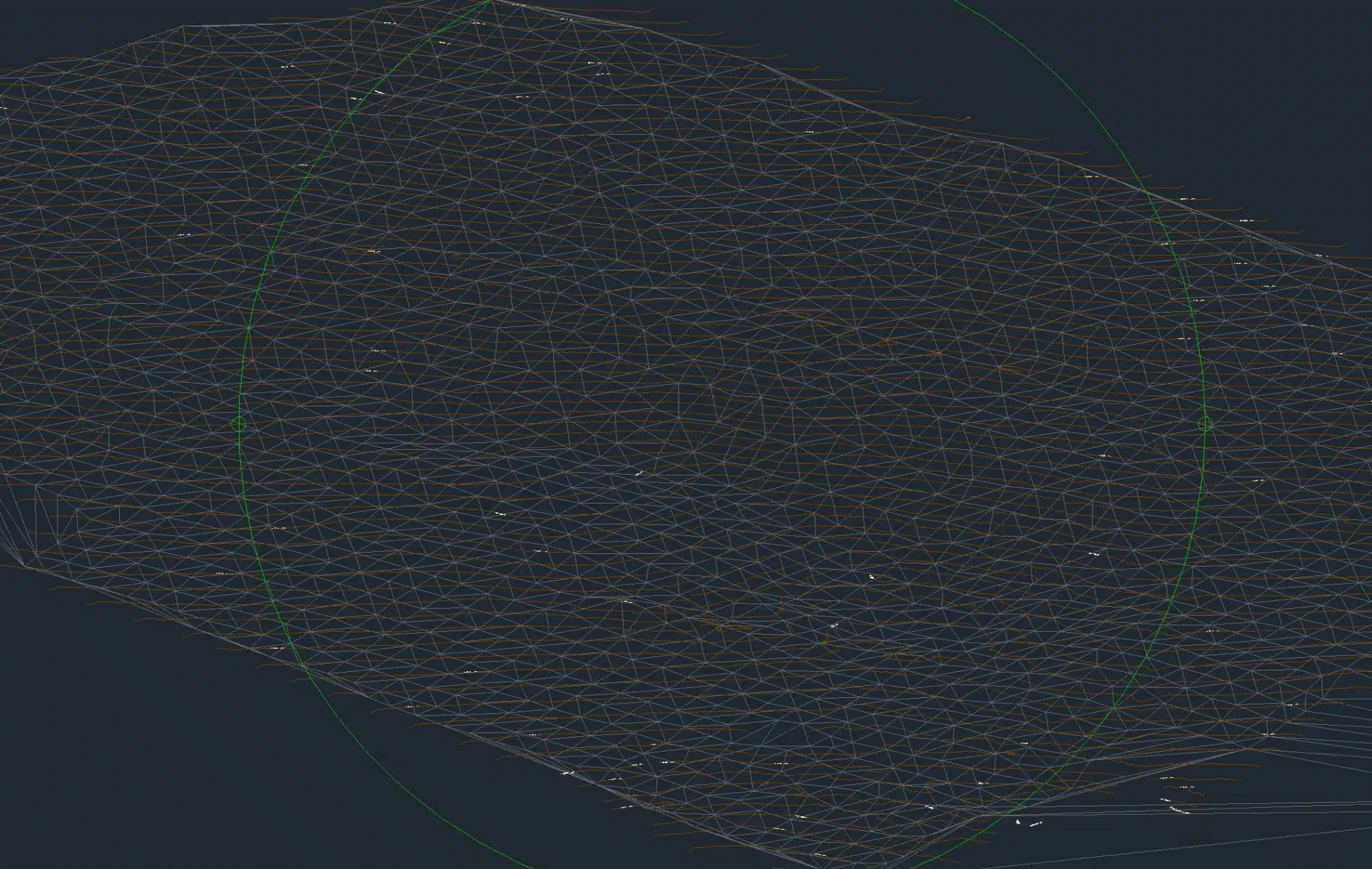
Bare-earth Digital Terrain Model with classified ground returns – ready for platform level designs and earthworks volumes.
Digital Surface Model
DSM capturing buildings, vegetation, and structures – for clash detection and visual context within the BIM model.
GeoTIFF Orthomosaic
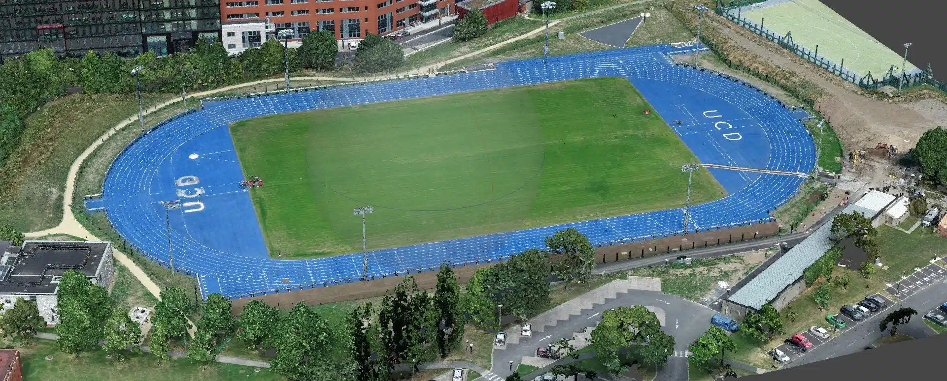
Full-resolution aerial map referenced to ITM – provides accurate visual context for site coordination.
DXF/DWG Drawings
Layered CAD drawings – spot levels, contours, boundaries, structures – ready for 2D coordination workflows.
RCP for Revit
Reality Capture Point Cloud format on request – native Revit point-cloud reference for direct family-level placement.
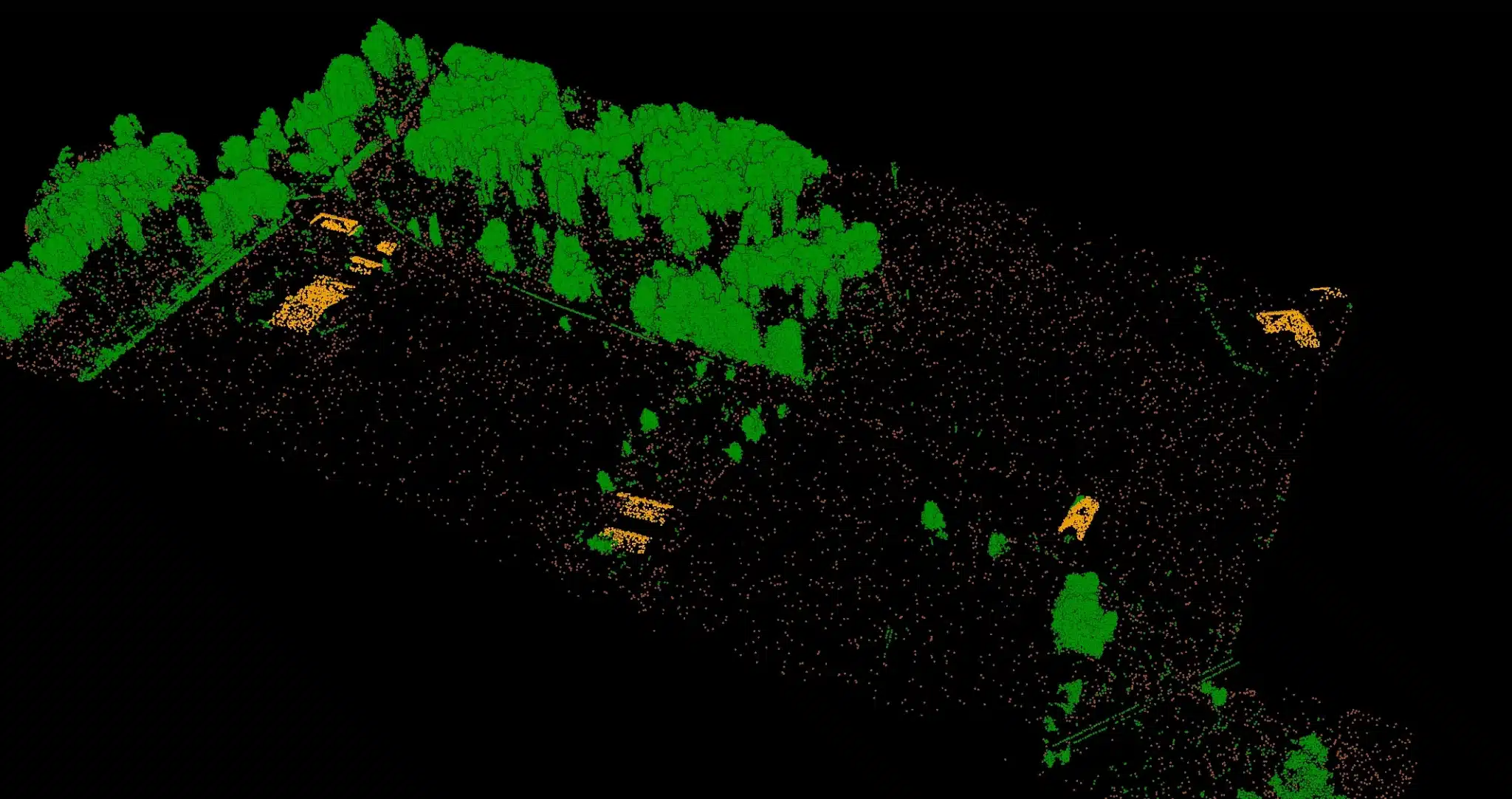
BIM Drone Survey Outputs
Real point clouds, classified surfaces, and orthomosaics from drone-captured BIM data across Ireland.
BIM Project Needs Existing-Conditions Data?
Send us your project coordinate system and target file formats – we’ll deliver a fixed-price BIM-ready survey with point cloud, DTM, and CAD outputs inside 48 hours of capture.
How a BIM Drone Survey Works
Capture, processing, and integration tuned for direct delivery into your BIM environment.
BIM-Aware Pre-Flight
We review your project coordinate system, target deliverables, and any existing BIM model. Capture density and methodology are tuned to your downstream workflow – whether existing-conditions for design, progress reference, or handover verification.
Aerial Capture & GCPs
A GCP network is established with the Emlid RS3 NRTK GNSS. For open sites we use the DJI Matrice 300 RTK with the Zenmuse P1 45MP camera. For sites with vegetation or complex geometry we deploy the Zenmuse L2 LiDAR sensor for full point-cloud capture under canopy.
Multi-Format Processing
Captured data is processed into a georeferenced point cloud (LAS/LAZ), classified DTM, DSM, GeoTIFF orthomosaic, DXF/DWG drawings, and on request, RCP files for Revit native import. All data is anchored to ITM coordinates with Malin Head datum heights.
BIM Integration & Handover
Deliverables are quality-checked against your project tolerance and delivered via secure portal. Where requested, we attend a model coordination meeting to walk your team through point-cloud import, classification filters, and clash-detection workflows in your chosen BIM environment.
How Drone Survey Data Supports BIM
Existing-conditions data, progress references, and handover models – all delivered in formats that integrate directly with your BIM environment.
BIM-based construction projects require accurate existing-conditions data at every stage. Drone surveys provide that data faster and more comprehensively than traditional ground survey methods, and the outputs can be delivered in formats that feed directly into your BIM environment.
What we deliver for BIM projects:
- Georeferenced point cloud (LAS/LAZ)
- Classified Digital Terrain Model (DTM)
- Digital Surface Model (DSM)
- Full-resolution GeoTIFF orthomosaic
- DXF/DWG drawings
- RCP (Reality Capture Point Cloud) file for Revit on request
- Survey report with coordinate system, datum, methodology, and accuracy
How drone survey data supports BIM:
- Georeferenced point clouds (LAS/LAZ) can be imported into Revit, ArchiCAD, Bentley, or Navisworks as existing-conditions reference
- Orthomosaic overlays provide accurate visual context for site coordination and clash detection
- DTM and DSM surfaces can be used to generate accurate earthworks volumes and platform level designs
- Progress orthomosaics at each monitoring visit allow BIM models to be updated against real-world conditions
- As-built drone surveys at project completion provide verified final geometry for handover models
- All data is delivered in ITM coordinates – compatible with Irish national BIM standards
Drone BIM Survey vs Terrestrial Laser Scanner (TLS)
Two complementary tools. Drone for site context and external geometry; TLS for interior and structural detail. On most BIM projects, you’ll want both – here’s where each is the right tool.
| Drone BIM Survey (DSI) | Terrestrial Laser Scanner | |
|---|---|---|
| Coverage type | Aerial top-down + oblique | Ground-up scan stations |
| Best for | External existing conditions, terrain, building shells | Interior scan-to-BIM, room-by-room geometry |
| Site setup time (5 ha) | 30–60 minutes on-site | Multiple scan stations, hours–days |
| Capture method | Single flight pass + GCPs | Multi-station registration |
| Output formats | LAS/LAZ + RCP + DXF/DWG + GeoTIFF | LAS/LAZ + RCS + ReCap |
| Horizontal accuracy | ±3cm with GCPs | ±2–3mm with multi-scan registration |
| Vegetation handling | LiDAR option for bare-earth under canopy | Limited to line-of-sight |
| Coordinate system | ITM / project grid (georef built-in) | Project grid (georef requires GCPs) |
For most BIM Level 2 projects requiring external existing conditions and site context, drone capture provides the right balance of speed, accuracy, and cost. For interior fit-out, structural element capture, or BIM Level 3 federated multi-discipline coordination, drone data should be combined with terrestrial scanning – the two layers stitch together cleanly when delivered in the same project coordinate system.
When Drone BIM Data ISN’T Enough
Drone surveys provide the right existing-conditions reference for site-wide BIM context, terrain, and external building geometry. There are workflows where a drone alone won’t give your BIM coordinator what they need.
Interior scan-to-BIM (rooms, corridors, MEP risers). Needs a terrestrial laser scanner – drone only captures exteriors.
Detailed structural element capture (steel connections, exposed reinforcement, fit-out detail). Needs TLS or close-up photogrammetry – drone resolution is ±3cm horizontal, structural capture typically needs sub-cm.
BIM Level 3 federated multi-discipline coordination. Drone provides the site-wide layer; you’ll also need TLS for interiors, MEP scan, and discipline-specific manual modelling.
Sub-cm tolerance for prefabricated clash detection. Drone captures at ±3cm; prefab clash workflows need ±5mm or better.
Confined-space mapping (tunnels, plant rooms, basements). Needs a handheld or backpack scanner – drone has neither the access nor the safety case for confined-space work.
Our Recommendation
Use drone capture for existing-conditions context, terrain, and exterior BIM. Pair with TLS for interior detail and structural elements. The two together give your BIM coordinator a complete reference model in less time than either alone – both delivered in your project coordinate system, ready for direct registration in Revit, Bentley, or Navisworks.
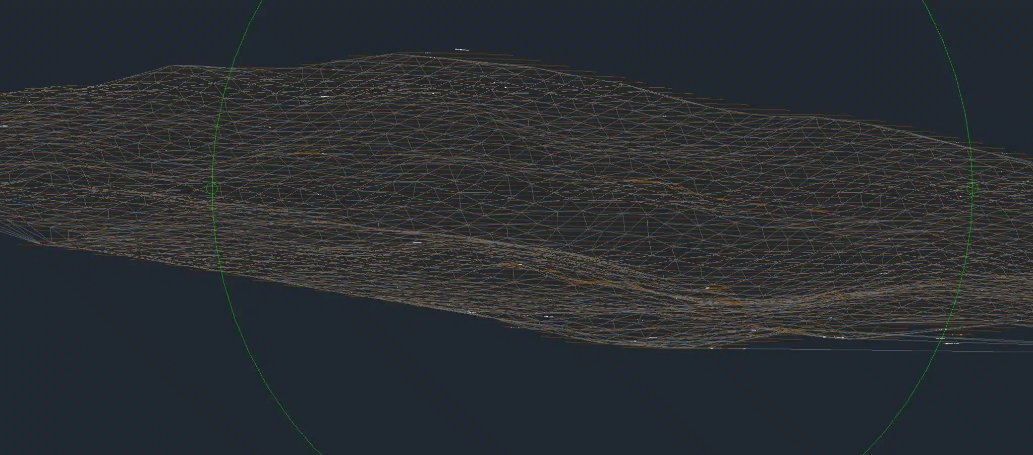
BIM-Ready Sample Outputs
Indicative deliverables from drone-captured BIM data – ready for direct import into Revit, Bentley, or Navisworks.

Where BIM Drone Surveys Are Used
BIM coordinators, design teams, and contractors across Ireland use drone data to populate, verify, and update their models.
Revit Existing Conditions
Navisworks Coordination
Bentley iModel Integration
Clash Detection
Progress Updates vs Model
Handover Verification
Frequently Asked Questions
Everything you need to know about our BIM drone survey service.
Request a 24-Hour Quote
Tell us about your project and we’ll respond within 24 hours with a detailed quote.
How we deliver: BIM Drone Survey
Drone-captured reality data formatted for direct import into Revit, Bentley iTwin, Navisworks, and ArchiCAD. Native outputs: LAS/LAZ classified point clouds, classified DTM/DSM, DXF/DWG drawings, RCP point clouds, and IFC/RVT meshes. All coordinates in ITM with OSGM15 Malin Head vertical datum, ensuring drone data aligns with Irish national BIM workflows and ISO 19650 information-management standards.
BIM drone capture coordinated by Fergal McCarthy under EASA Specific Category authorisation. Drone Services Ireland has operated commercially since 2016.