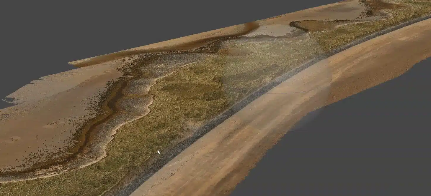
In December 2022, Drone Services Ireland flew photogrammetry baseline surveys of Streedagh, Enniscrone and Dunmoran Strand for Sligo County Council – the reference dataset against which future coastal change will be measured.
Coastal erosion is measured over years, not weeks. Sligo County Council needed a defensible, georeferenced record of three of the county’s most exposed beaches – Streedagh, Enniscrone and Dunmoran Strand – so that future surveys could quantify exactly how much shoreline, dune and beach volume had moved, rather than relying on photographs and recollection.
A baseline only has value if the next survey can be compared to it precisely. That set the requirement: survey-grade ground control, consistent coordinate referencing in ITM (EPSG 2157), and deliverables an engineer can lay a future dataset over without ambiguity.
The surveys were flown by photogrammetry in December 2022 – winter conditions, low vegetation and exposed beach profiles, the right season for capturing the coast as it stands.
Each beach was controlled with surveyed ground control points to DSI’s standard survey-grade accuracy, referenced to ITM (EPSG 2157). On a coastline the control is the whole point: a future survey tied to the same reference frame can be differenced against this one directly.
Overlapping aerial imagery across the full beach, dune and foreshore extents at each site. Winter timing meant low vegetation on the dunes and clean beach profiles – the conditions that give a coastal baseline its clarity.
Imagery was processed into orthomosaics and digital surface models with contours and shoreline profile lines – the products a coastal engineer overlays a later survey on to quantify retreat, dune loss and sediment movement.
Coastal monitoring of this kind is typically repeated on a cycle of around five years, or after a significant storm event. The 2022 dataset is held ready for that comparison: same sites, same reference frame, same deliverables. See our coastal erosion monitoring service for how repeat surveys are structured.
Streedagh, Enniscrone and Dunmoran Strand captured to the same ground-control standard and coordinate system, so change can be measured consistently across all three.
Orthomosaics, surface models, contours and shoreline profiles delivered in formats the council’s engineers and consultants can overlay future surveys on without re-referencing.
A baseline is the least visible survey a council buys and the most valuable: every future dataset gains meaning against it, and every planning or coastal-defence decision gains a measured starting point.
Managing a coastline, estuary or eroding site? Coastal erosion monitoring covers baseline and repeat surveys, and local authority drone services covers procurement-ready programmes. Request a 24-hour quote or call 087 205 2331.
Baseline and repeat surveys that quantify shoreline retreat, dune loss and sediment movement over time.
Survey-grade orthomosaics, surface models and contours with ITM / EPSG 2157 ground control.
Survey, monitoring and inspection programmes for councils, procurement-ready across all 32 counties.
No obligation, no hidden costs. Tell us about your site and we will come back with a methodology and price.