How drone positioning actually works
When an engineer commissions a drone survey, the accuracy of what they get back depends on how precisely the drone knew where it was when each photo was taken. Two technologies handle this: Real-Time Kinematic (RTK) and Post-Processed Kinematic (PPK). Both get you centimetre-level positioning, but they go about it differently, and the practical implications are worth understanding.
RTK in a nutshell
RTK corrects the drone’s GNSS position in real time during flight. A base station – either a physical unit on site or a virtual station from a CORS network like SMARTNET – sends correction data to the drone via radio or mobile data link. The drone applies corrections on the fly, hitting plus or minus 1 to 2 cm horizontal and 2 to 3 cm vertical while airborne.
What’s good about RTK
- You know during the flight whether positioning is working properly
- Image positions are already corrected – no GNSS post-processing needed
- Faster turnaround from flight to deliverable
What can go wrong
- If the correction signal drops – mobile blackspot, radio interference, too far from the base – the drone falls back to standalone GNSS accuracy (1 to 2 metres). Any images captured during that dropout are poorly positioned.
- You need either a physical base station in range or reliable mobile coverage for network RTK
- If corrections were poor during flight, you can’t fix it afterwards
PPK in a nutshell
PPK records raw GNSS observations on the drone during flight, with precise timestamps for each image. After landing, these raw observations get processed against base station data (from a site base or CORS network) using GNSS processing software. The corrections are applied retrospectively, and you get the same or better accuracy as RTK – typically plus or minus 1 to 2 cm horizontal, 2 to 3 cm vertical.
What’s good about PPK
- No data link needed during flight. This is the big one. The single biggest failure point of RTK is eliminated.
- Full control in post-processing – you can pick the best base station data, adjust parameters, verify solution quality after the fact
- Works everywhere, including remote sites, valleys, coastal areas, and anywhere mobile coverage is patchy
- Every image position can be checked and, if needed, re-processed
The downsides
- No real-time feedback – you don’t know during the flight if something went wrong with the GNSS. That only shows up in processing.
- An extra processing step before photogrammetry can begin
- You need base station data recorded simultaneously (though OSi CORS data is freely available in Ireland)
What we actually do
Our survey-grade platforms support both. Standard practice: we fly with RTK active and PPK recording at the same time. That gives us real-time confidence during the flight and a PPK safety net for any images where the RTK fix dropped or degraded. For anything that matters, we verify the GNSS solution quality in post-processing regardless.
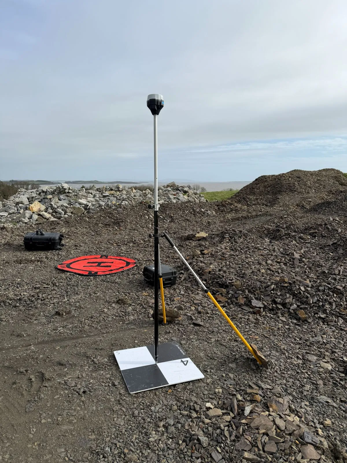
Do you still need ground control points?
This is the question we get most. Short answer: for engineering work, yes – but fewer than without RTK/PPK.
Direct georeferencing alone can hit plus or minus 2 to 3 cm without any GCPs. But for projects where the data feeds into design, earthworks calculations, or contractual measurement, we always recommend at least 3 to 5 GCPs as independent check points. They don’t need to be used in the photogrammetric adjustment – they’re there to independently verify that the survey accuracy meets your spec.
If you need the tightest accuracy (plus or minus 1 to 2 cm), GCPs are still necessary. They correct for residual systematic errors in the GNSS solution and the camera calibration. More on this in our accuracy guide.
Practical advice for engineers
When writing tender specs
Don’t specify RTK or PPK – specify the accuracy you need and let the operator figure out the methodology. “Achieve plus or minus X cm RMSE at independent check points” is technology-neutral and focuses on what actually matters.
When reading survey reports
Ask for the GNSS processing report showing fix quality for each image. In a PPK report, you want to see “Fixed” solutions (integer ambiguity resolved) on all images. “Float” solutions mean lower confidence and potentially reduced accuracy in those areas.
When comparing quotes
A cheaper quote using smartphone-grade GNSS with heavy GCP reliance can still produce good results, but it needs more ground survey and is more sensitive to GCP placement. Survey-grade RTK/PPK costs more in equipment but reduces the ground work. The right choice depends on site size, access, and how tight your accuracy spec is.
Need advice on the best approach for a specific project? Talk to our survey team.