Where construction disputes come from
Construction disputes cost the Irish industry millions every year in legal fees, stalled projects, and broken relationships. The SCSI consistently identifies the same triggers: variations and scope arguments, measurement disagreements, programme delays, and differing site conditions claims.
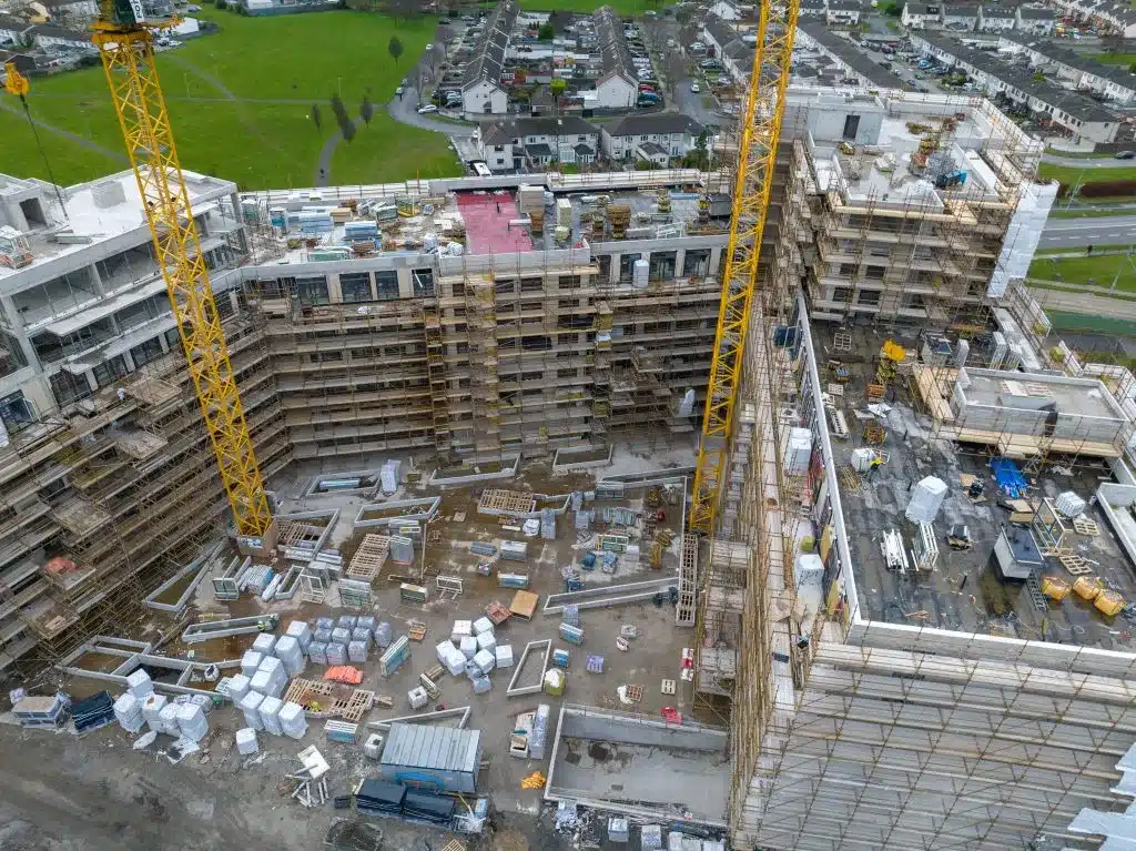
The common thread is incomplete or conflicting records of what actually happened on site. Drone monitoring fills that evidence gap with an objective, timestamped, measurable record at regular intervals throughout the project.
Measurement disputes
The typical argument
Disagreements over quantities – earthworks volumes, paving areas, extent of completed work – are probably the most common final account headache. Traditional measurement uses periodic ground surveys that sample the site at discrete points, with volumes calculated by interpolation.
What drone data changes
Drone surveys capture the complete surface at each measurement. Volume calculations come from continuous surface comparison, not interpolated cross-sections. Both sides work from the same dataset. There’s no argument about where sections were taken or whether the grid was dense enough.
For payment certification, that means faster agreement on interim valuations and fewer items dragging into final account.
Programme and delay disputes
The typical argument
Delay claims under NEC, FIDIC, or the Public Works Contract need cause and effect – proof that a specific event delayed the critical path. Traditional evidence is site diaries (subjective), ground-level photos (limited view), and people’s recollections months later (unreliable).
What drone data changes
Regular surveys – weekly, fortnightly, monthly – produce a timestamped visual and 3D record. Each orthomosaic shows exactly what was happening across the entire site on that date. When a delay claim comes in, you have:
- Evidence of what was actually complete, in progress, or not started at each date
- Visible impediments – standing water, incomplete predecessor works, access problems, material shortages
- Planned versus actual progress comparison showing where things diverged
- Weather impact documentation when imagery is captured during or after bad weather
That kind of contemporaneous evidence carries a lot more weight than someone’s memory of events six months ago.
Differing site conditions
The typical argument
Claims for unforeseen ground – rock, contamination, soft spots, undisclosed services – usually come down to what the contractor could reasonably have expected before tendering.
What drone data changes
A pre-construction drone survey captures visual and topographic conditions before work starts. Combined with the topographical survey, you get an objective record of:
- Visible ground conditions and surface features
- Existing levels and terrain shape
- Watercourse positions, standing water, drainage patterns
- Vegetation type (often indicative of ground conditions)
- Existing structures, services, access
That helps establish what was visible and foreseeable at tender stage.
Variation disputes
When there’s a disagreement about whether a variation was instructed or the contractor just did their own thing, sequential drone surveys show what was built, when, and how it compares to the original design. Surface models can be overlaid directly on design drawings to quantify departures.
Environmental and neighbour complaints
Third-party disputes – neighbours, regulators, road authorities – about noise, dust, drainage, or boundary encroachment. Drone imagery provides dated evidence of:
- Boundary positions relative to works
- Environmental controls (silt fences, settlement ponds) in place at specific dates
- Extent of activity near sensitive areas
- Vegetation clearance timing and extent
Why drone evidence carries weight
In adjudication, conciliation, arbitration, and court, drone data is strong evidence because it’s:
- Created at the time, not reconstructed later
- Measured data, not opinion
- Covers the whole site, not selected viewpoints
- Can be independently re-processed or re-analysed
- GPS and EXIF data embed date, time, and location
Start early, not after the problem
The most cost-effective approach is setting up regular monitoring from day one. Monthly drone surveys over a 12-month contract cost a fraction of a single adjudication, and the data does double duty for progress reporting, payment certs, and stakeholder communication.
If you’re already in difficulty, we can still capture current conditions and set a baseline going forward – but the earlier record won’t exist.
Talk to us about monitoring for your project. More on our construction monitoring service.